 |
| Map of 1841 showing lost footpath highlight |
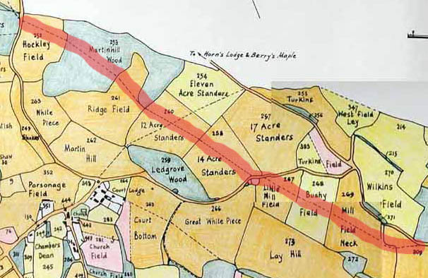
I was looking at the old map of 1841 and found evidence of a footpath which has completely disappeared. I wonder what happened to it?
It comes off the Vigo Road, and goes over the small field (which usually contains sheep) to the stile - that is as it is today. But instead of heading off towards Stansted, as it does now, it cuts across to the pond at the top of Stansted Hill, crosses the road and then shoots straight across to come out some way down Malthouse Road. The footpath then crosses the road and comes out near to the Anchor and Hope pub on the South Ash Road. This part is also still used today.
What happened to the middle section? I wish it were still there as you get some good views from that area. Interestingly, if you look at a modern satellite map the section which went through the woods is still obvious, see below.
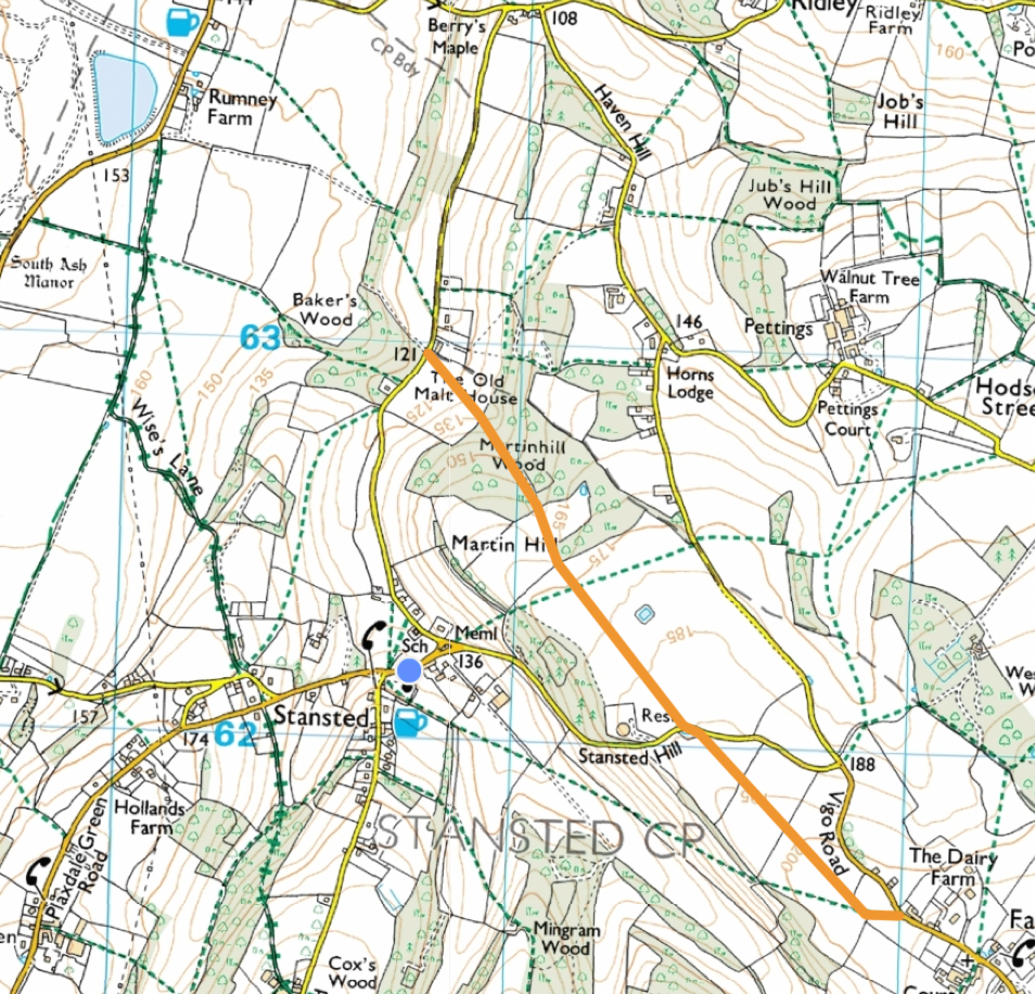 |
| Missing section (in orange) OS view. |
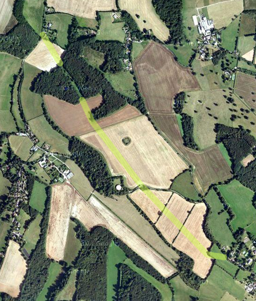 |
| Missing section satellite view (showing cut in trees where path went) |
I have been doing some research on the lost Stansted Mill and I am pretty sure that it stood more or less directly on this footpath. So, maybe, when the mill ceased to exist, so did the footpath? I'll post my research on this site so you can see it.
ReplyDeleteSuper! Are there any photos of the mill in existence, do you know?
DeleteI think that this was a footpath to Stansted windmill which stood in Little Mill Field. We have some maps and an1907 anecdote which place it there (or close by).
ReplyDeleteA footpath to a mill would make complete sense. I knew there was a mill somewhere but wasn't sure where it was. Looking at the field names it was obvious it should be in Little Mill Field! But then two fields away towards Fairseat is another called Mill Field Neck. Hmmmmmm....
DeleteIt disappeared pre photography (probably in the mid to late 1700s) and there are no paintings of it that I have seen (other than a drawing on a map).
ReplyDeleteI don't think that I can post a photo on here can I? I'll send it privately if you would like to see it. The windmill is shown on a 1682 map of Fairseat.
ReplyDeleteHi Dick, yes I'd love to see it, I think you have my email address?
Delete